CyclingClimb
Nice · 1 June 2026 · Marvin
The 5 Climbs Every Cyclist Should Ride from Nice
Read →5 min read
Ninety-five kilometres from Nice into the hinterland and back. The Col de Vence is the reason — 9.6 kilometres of south-facing climbing above an artists' town, with the Mediterranean laid out below at the top.
93 km
Distance
1,297 m
Elevation
5h10
Duration
2 ravitos
Ravitos
Nice is not a place that hides its pleasures. The Promenade des Anglais announces the Mediterranean with the kind of confidence that doesn't need to be earned. But leave the seafront and ride west along the cycle path, and the city begins to negotiate. The traffic thins, the apartment buildings give way to garden walls, and after twenty minutes on the flat Var valley road, you are already somewhere else.
The Var river runs north to south through limestone gorges before it reaches the sea near the airport — a geography that has made this corridor one of the main access routes to the Alpes-Maritimes hinterland for a long time. You follow it north, the gradient almost imperceptible, the mountains gathering on either side. Vence appears ahead as a suggestion before it becomes a destination — a medieval hilltop town that spent the twentieth century accumulating artists the way other towns accumulate churches. Matisse lived here. Chagall has a museum. Picasso passed through. None of this is immediately visible from the road, but you feel a certain density to the place, a cultural weight that doesn't announce itself.
The fountain is at the junction where the road begins to climb. It is not a monument — just a cast iron tap on a wall, with cold water that the town has been famous for since long before anyone thought to ride a bike up its mountain. Fill everything. This is the last water until Le Broc, and the Col de Vence is entirely exposed.
The Col de Vence begins almost immediately: a first kilometre of urban ramp at a steady 7% that clears the last houses and empties onto open hillside. Below the Baou des Blancs — a limestone escarpment that overlooks the early part of the ascent — the gradient softens briefly to around 5.5%, a false respite before the valley of the Lubianne narrows and the landscape begins to desertify. South-facing, rocky, virtually no shade after the third kilometre. In summer, riders who start after ten in the morning remember this fact clearly by the time they reach the top.
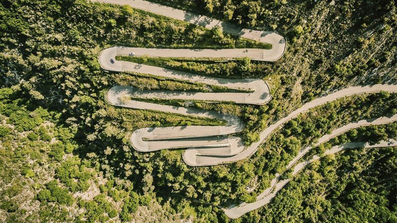
Then six hairpins, in quick succession, lifting the road above its own previous level. And then the long upper section — 5.6 kilometres at a sustained 7%, where the effort is less about gradient than duration. Two kilometres from the summit, if you can spare the attention, the Mediterranean appears: the whole arc of the Côte d'Azur from the Italian border to Antibes, with Nice laid out below like a map of the morning you just left behind. The col itself — at 962 metres, in the Parc des Noves — is all bare rock and scrub, with nothing between you and the sky.
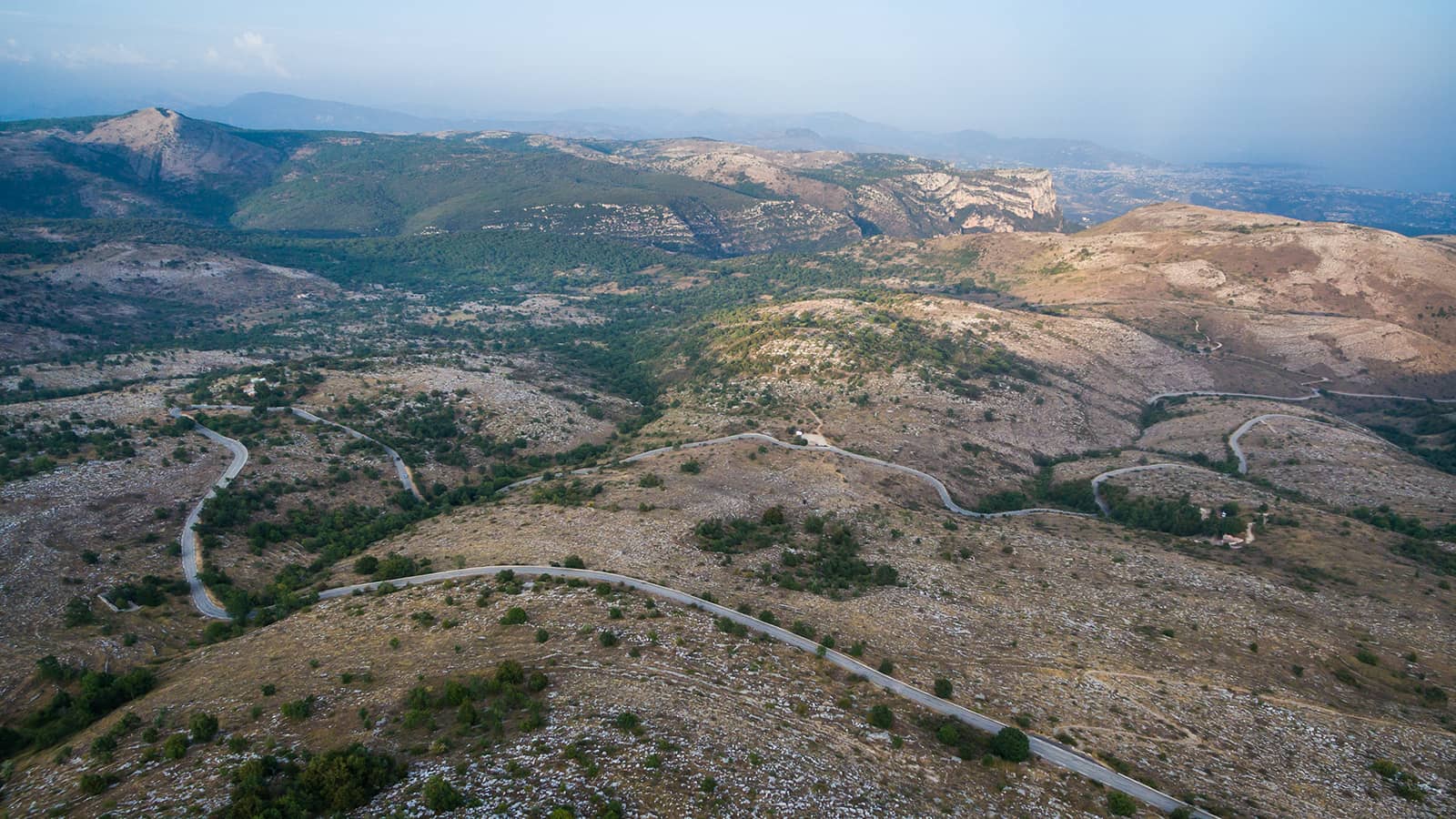
On the other side, the plateau of Saint-Barnabé opens into something the descent doesn't prepare you for: high pastoral country, farms, stone villages, the light different from the coast in a way that takes a moment to identify. You are in the hinterland now, and the hinterland has its own pace. Bouyon is the first village — a belvedere above the Var valley, 400 metres of street and a water point. Then the road drops toward Le Broc, which has a boulangerie, a café, and the particular quality of a village that has remained exactly what it is without trying to be anything else.
The descent back to the Var valley is fast and open, the river appearing below, and then the flat corridor south — the same road you climbed in the morning, now ridden in the other direction with the mountains behind you. Nice reappears gradually: first the coastal plain, then the suburbs, then the seafront. The cycle path carries you back east.
The route offers a variation for those who want one final climb: cross the Var at Le Broc and take the signed road through Castagniers and Aspremont before a back-roads descent into Nice. An extra 250 metres of climbing, quieter roads, a different angle on the city at the end. Worth knowing it exists.
The fountain at the foot of the col in Vence is non-negotiable: fill every bottle here. The Col de Vence is fully south-facing with no shade from kilometre 3 onwards, and the plateau above offers no reliable water source until Bouyon. In summer, this is not optional — it is the difference between a hard ride and a bad one.
Summer timing: start before 8am if riding in July or August. The upper section of the col is fully exposed and gets brutal by mid-morning. Local riders do not climb this col at noon in August — not even the fast ones.
Traffic: Vence to the col sees regular car traffic, especially on weekday evenings (commuters heading for the hinterland villages). Early morning gives you cleaner roads and better light.
The descent is technical: the south side descent back into Vence is sinuous with some passages that reward attention. Fast, but not a place to switch off.
93 km
Distance
1,297 m
Elevation
6.7%
Average gradient
1,018 m
Summit altitude
Variant: via Castagniers & Aspremont
+~250 m / quieter backroads / alternative descent into Nice
Before you go
From the journal
Nice · 1 June 2026 · Marvin
Get the Ravito guide in your inbox.
No noise. Unsubscribe anytime.