Expedition
Nice · 18 July 2026 · Simon
What Nobody Tells You About a 4-Day Cycling Trip in the South of France
Read →3 min read
Christophe · 6 June 2026 · 7 min read · 11 views

Provence · Road · 135 km · 4 800 m · For the slightly unhinged
There is a category of cycling achievement that sits between a hard day out and a genuine ordeal. The triple ascent of Mont Ventoux — all three roads, same day, same legs — sits firmly in that category. It has a name in French cycling culture: les fous du Ventoux. The madmen of the Ventoux. The name is affectionate. Mostly.
The logic is simple and slightly insane. Ventoux has three ascents. Bédoin from the south, Malaucène from the north, Sault from the east. Each one summits at 1 912 metres. Each one is a complete ride in its own right. The question — asked, apparently, by people with too much fitness and too little self-preservation — is what happens if you do all three consecutively, in a single day, without stopping except to eat and fill your bottles.
The answer is approximately 135 kilometres, 4 800 metres of elevation, and a relationship with the mountain that you will not forget.
The honest answer is that the triple ascent is not a race, not a performance test, and not something you do to be faster at cycling. You do it because Ventoux demands it. The mountain is singular enough — historically, visually, physically — that the idea of seeing all three of its faces in a single day makes a kind of obsessive sense that is difficult to explain to non-cyclists but requires no explanation to anyone who has stood at the Bédoin start and looked up.
It is also, once completed, something you carry permanently. Not the Strava segment. The memory of the third summit — Sault in the afternoon light, legs that have already climbed 3 600 metres, the road stretching ahead with a certainty that this was the correct use of a day.
The classic order is Bédoin first, Malaucène second, Sault third. This is not arbitrary.
Bédoin is the hardest. You do it first because your legs are fresh and because the forest section demands a quality of focus that is harder to sustain late in a long day. Malaucène second because it is technically demanding in a way that benefits from relative freshness. Sault last because its gentler gradient — 4.7% average versus Bédoin's 7.5% — is survivable on legs that have already climbed 3 200 metres, and because the plateau light in the late afternoon is one of the rewards the day keeps in reserve.
Total distance: 135 km
Total elevation: 4 800 m
Three summits at 1 912 m
Estimated duration: 7 to 11 hours moving time depending on level
21 km · 1 617 m · avg 7.5%
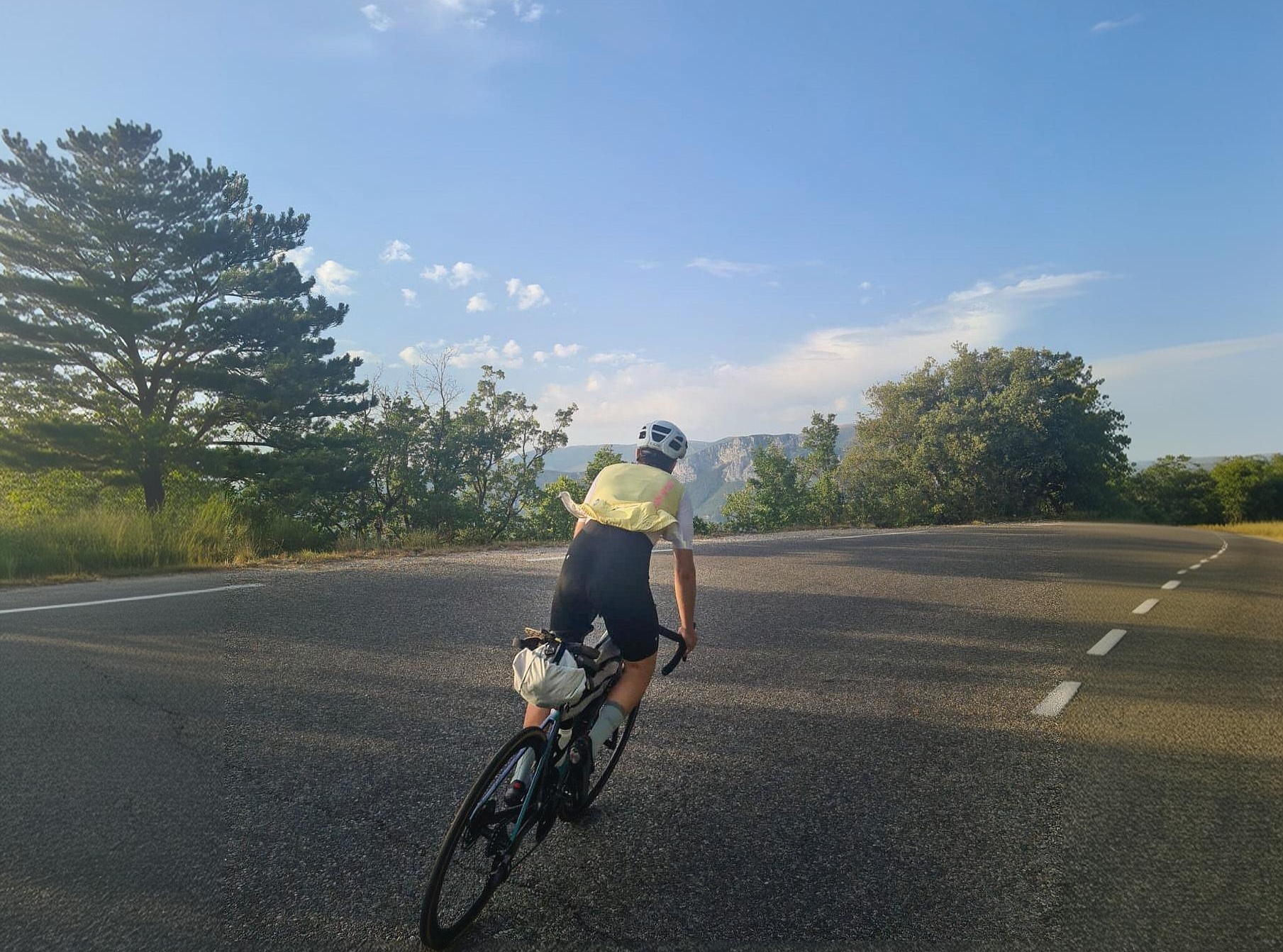
Start at Café du Cycliste in Bédoin. This is non-negotiable. The coffee is good and the symbolism is correct — starting the hardest day you will have on a bike from the most logically named café in Provence.
Leave before 7am in summer. The Bédoin forest section — nine kilometres at 9% average — generates heat even in shade, and you want the upper mountain before the sun has fully committed to the day.
The forest requires patience. The gradient never relents and the road never straightens, and the temptation to accelerate into every corner to see what is around it is the enemy of a successful triple ascent. What is around the corner is more gradient at the same angle. This is not a surprise. Ride accordingly.
Chalet Reynard at 1 440 metres is the transition. Below it: forest, shade, contained effort. Above it: limestone, sky, exposure, and the six kilometres that make Ventoux what it is. The Simpson memorial at km 20, 1.5 kilometres below the summit. A brief stop. Then the final kilometre to 1 912 metres.
First summit. One down. Two to go. The descent to Malaucène begins immediately.
~18 km · Descent then valley riding
The descent from the Ventoux summit to Malaucène takes 30–40 minutes. It is fast, technical in the exposed upper section, and requires full attention — which is inconvenient after a 21-kilometre climb but unavoidable. Hands on the drops. Weight back. Brake before the corners, not in them.
The lower section of the Malaucène descent is smoother, faster, and delivers you into the village via a series of long sweeping curves through the forest. Malaucène is a Friday market town with good bakeries and a pharmacy — the latter potentially useful depending on how the day develops.
Eat here. Properly. The second ascent begins from Malaucène's central square and your body has already climbed 1 600 metres. A coffee and a pain au chocolat is not sufficient. Sandwich, cake, whatever the bakery has — this is the most important nutrition decision of the day.
21 km · 1 532 m · avg 7.2%
The northern side is the one most riders know least. The road is quieter, the gradient more irregular — ramps to 12% followed by brief sections of 4–5% where the legs can recover — and the forest darker and cooler than Bédoin.
By the time you leave Malaucène your legs know what they're doing. The first 1 617 metres have taught them the specific language of this mountain. The Malaucène ascent speaks a different dialect — less consistent, more conversational — but the vocabulary is the same.
The key section is between km 8 and km 14 from Malaucène, where the gradient becomes genuinely irregular and the road winds through the oldest section of forest on the northern slope. This is where the second ascent develops its own identity separate from the first. It does not feel like a repeat. It feels like a different mountain, which in most important respects it is.
The Col des Tempêtes junction at 1 826 metres, 1.5 kilometres from the summit, is where the Malaucène road joins the shared summit approach. The final section is familiar — you descended it 90 minutes ago. It looks different going up.
Second summit. 3 149 metres climbed. Sault remains.
The descent toward Chalet Reynard, then the D164 east toward Sault. This link is approximately 25 kilometres, mostly descent and plateau riding, which sounds like rest and is — comparative to what came before and what is coming.
26 km · 1 210 m · avg 4.7%
The mathematics of the triple ascent reserve their cruelty for here. The Sault approach is the longest by distance and the gentlest by gradient — the ascent that, encountered fresh, feels almost manageable. Encountered after 3 200 metres of climbing and 90+ kilometres of riding, it reveals itself as something else entirely.
The body at this point is running on a different fuel than it started on. The legs are present but negotiating. Every kilometre is a conversation between effort and residual capacity. The gradient — 4.7% average, rarely above 7% — that seemed gentle in the description now appears as a sustained demand on muscles that have been working for six or seven hours.
This is the section where the triple ascent becomes honest with you about what you asked of it.
Leave Sault without hesitation. Stopping too long at the transition allows the legs to stiffen and the mind to begin calculating how far it still is. The Sault road is kinder if you treat it as a continuation rather than a fresh start.
The plateau section — the first 15 kilometres from Sault — crosses open lavender country at gradients between 3 and 6%. In July the lavender is flowering and the plateau has a particular smell that you will associate forever with whatever state your legs are in at this moment. The Ventoux, visible ahead the entire time, grows slowly.
Chalet Reynard at km 21. For the third time today you cross the treeline. For the third time the limestone appears. The summit is 1.5 kilometres from where you joined this road on the descent from the second summit three or four hours ago. It looks the same. Everything else is different.
The final kilometre. The gradient to 10%. The last corner. The summit plateau.
1 912 metres. Three times.
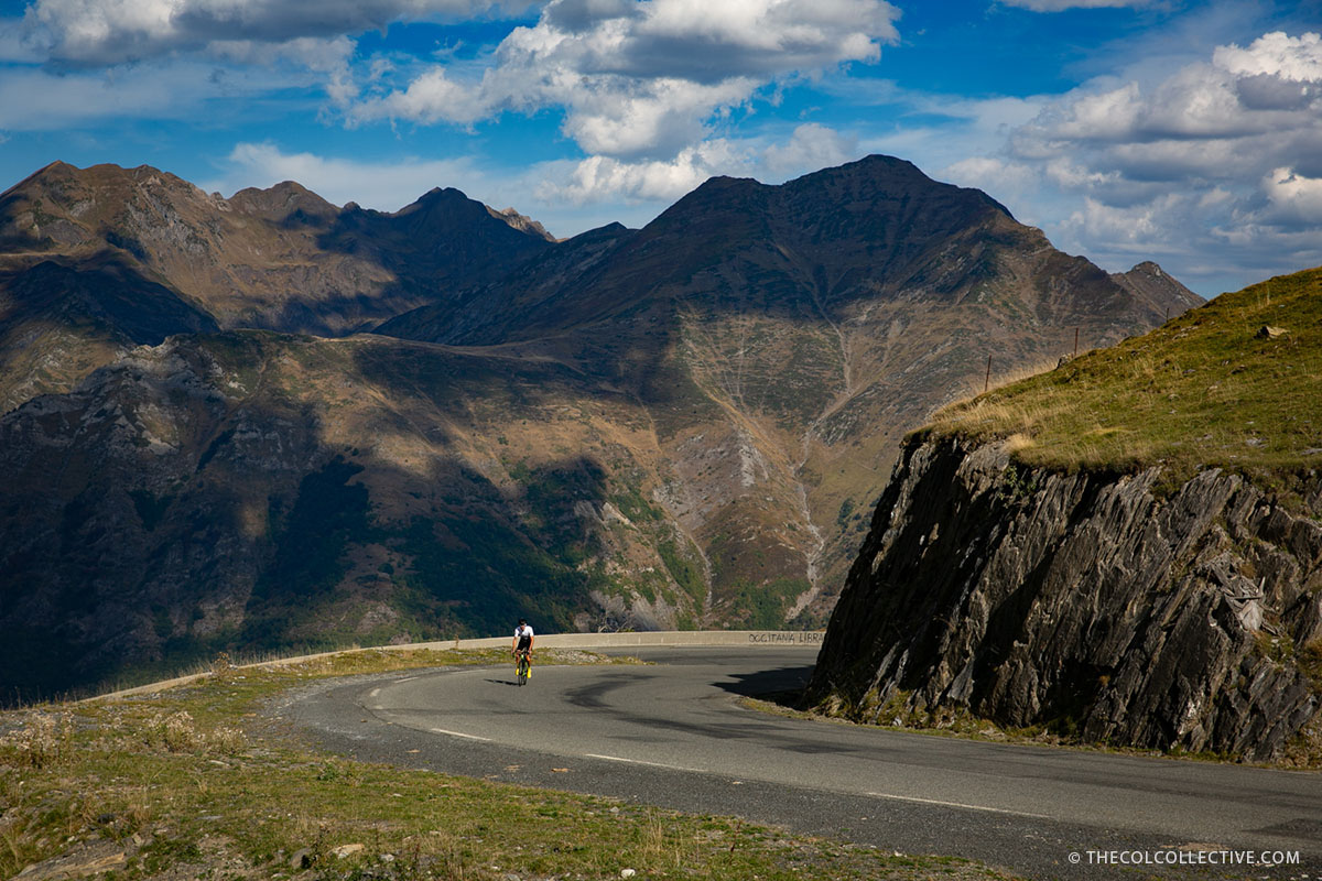
Not triumph, exactly. Something quieter. The mountain has been climbed three times and is still there, unchanged, indifferent to the achievement. The meteorological station still turns. The mistral, if present, still blows. The view is the same view it was from the first summit — the Alps to the east, the Mediterranean to the south, the Cévennes to the west.
What has changed is the relationship between you and the mountain. You have seen all three of its faces in a single day. You know what it looks like from the south, from the north, and from the east. You know which approach feels hardest on fresh legs and which feels hardest on tired ones. You know the difference between the Bédoin forest at 7am and the Sault plateau at 4pm.
Most cyclists who come to Provence summit Ventoux once. Some come back for a second time, to improve the time or try a different road. The triple ascent is for the people who feel that one side of the mountain was not enough to understand it, and two sides only raised the question of what the third would be like.
Now you know.
Start point: Café du Cycliste, Bédoin. Open from 10:00 — if you plan an early start, fuel up the night before.
Order: Bédoin → Malaucène → Sault. Do not attempt Sault first. The logic of completing the hardest ascent on fresh legs is not optional.
Food: Bédoin before departure, Malaucène between ascent 1 and 2, Chalet Reynard between ascent 2 and 3 (they are open in season). The summit café is unreliable — do not depend on it. Carry more food than you think you need.
Water: Fill at every opportunity. The exposed sections of all three ascents generate significant sweat loss. Dehydration on the third ascent is a common cause of abandonment.
Weather: Check summit conditions the evening before. Wind gusts above 60km/h make the triple inadvisable — not because the climbing is impossible but because the descents become dangerous. The Ventoux weather station publishes real-time data.
Season: May–June and September are optimal. July and August are possible before 7am and inadvisable after 11am on the Bédoin approach. October is beautiful and cold above 1 500 metres.
Time: Allow 9–12 hours depending on level. Most riders complete the triple between 8 and 10 hours moving time. Do not plan anything for the evening.
Café du Cycliste — Ventoux · 286 Route du Mont Ventoux, Bédoin. Start here. If you survive, return here. The team has seen this before and will treat you accordingly.
The full route — 135 km, 4 800 m, three summits — is available on the Ravito strava Strava.
Weekly guide
More from the Journal
Nice · 18 July 2026 · Simon
Nice · 1 June 2026 · Marvin
Pyrenees · 16 May 2026 · Christophe
Five days. Four riders. One route. The premise was simple: gravel bikes, minimal bags Everything else we figured out on the road.
Get the Ravito guide in your inbox.
No noise. Unsubscribe anytime.