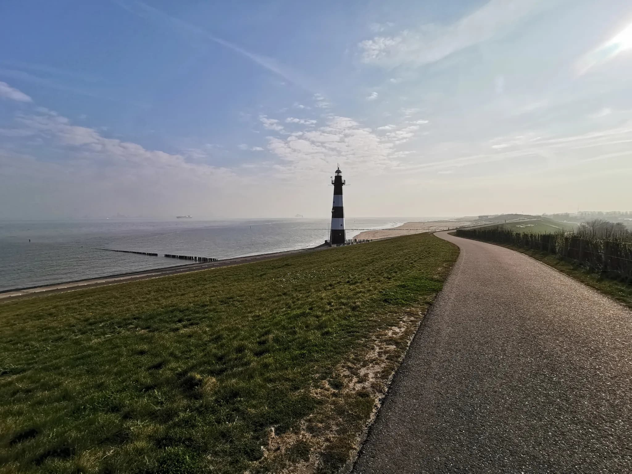
Three Days Across Western Brittany
The Journey — Three days. Several different Brittanys.
571 km
Distance
6,510 m
Elevation
33h00
Duration
13 ravitos
Ravitos
Three days. Around 570 kilometres. More than 6,600 metres of climbing.
This bikepacking loop begins in Goudelin, crosses the northern coast of Brittany, reaches deep into the Crozon Peninsula, follows the southern shoreline towards Guidel, then cuts straight back through the centre of the region.
There are no high mountain passes here. Instead, the difficulty comes from repetition: short climbs, fast descents, narrow country lanes and constant changes of rhythm. The sea is never far away, but reaching it often means crossing another line of hills.
Most of the route is paved, with only a few short sections of light gravel. The small stones are compact and easy to ride, even on a road bike.
More than the numbers, however, this is a journey through several different versions of Brittany: quiet bocage at sunrise, fishing harbours, dramatic headlands, historic towns, military landscapes, Atlantic beaches and wheat fields freshly cleared after the harvest.
And along the way, there is always somewhere to stop for coffee, a pastry, a cold drink or a well-earned meal.
| Start and finish | Goudelin |
| Duration | 3 days |
| Distance | 569 km |
| Elevation gain | 6,619 m |
| Surface | Predominantly paved, with a few light gravel sections |
| Style | Fast, road-focused bikepacking |
Day 1 — Goudelin to Rosnoën
262 km | 2,839 m of climbing
The first day is the longest, beginning before the roads have properly woken up.
Leaving Goudelin at first light, the route immediately enters the countryside of Côtes-d'Armor. Small villages appear between hedgerows, while the sun slowly rises over open fields on the horizon.
This is Brittany at its quietest.
The roads are narrow, the landscape is still and the first kilometres pass through a mixture of farmland and bocage. There is no dramatic landmark yet — just the feeling of moving steadily west as the daylight grows stronger.
The route soon reaches Pontrieux, a small town full of character built along the Trieux. From here, the river leads towards the northern coast and the English Channel.
After following the shoreline, the road turns inland again along the Jaudy before crossing the bridge towards Tréguier.
Breakfast in Tréguier
Tréguier is the first real pause of the day.
At Le Rest'à Flots, the morning begins properly with pastries, orange juice and coffee. It is also possible to find one of Brittany's most recognisable local drinks here: Breizh Cola.
After the early start through the countryside, sitting down for breakfast feels like the point where the journey truly begins.
From Tréguier, the route continues towards the coast, occasionally leaving the asphalt for short sections of very light gravel. The surface is made up of small, compact stones and remains easy to ride on a road bike.
Perros-Guirec and Ploumanac'h
Arriving in Perros-Guirec, it is worth making a short detour towards the lighthouse at Ploumanac'h.
The headland is one of the most recognisable landscapes on the route. Rock formations, open sea and the lighthouse combine to create a view that feels immediately different from the quiet agricultural roads of the morning.
In only a few hours, the route moves from silent bocage to one of Brittany's most iconic coastal panoramas.
After Ploumanac'h, the ride continues along the northern coast. The sea repeatedly disappears behind hills and villages before returning at the next opening in the landscape.
The kilometres begin to accumulate, but the constant changes of scenery keep the route moving.
Lunch in Plougasnou
In Plougasnou, Ty Gasnou provides the main lunch stop of the day.
The restaurant sits opposite the small church in the centre of the village, in a setting that feels unmistakably Breton. The food is traditional, the service warm and the atmosphere relaxed.
It is the kind of place that works perfectly on a long-distance ride: unpretentious, welcoming and generous enough to prepare you for another full afternoon on the bike.
From Plougasnou, the route reaches the river leading towards Morlaix. It follows the water inland, passes through the town, then returns towards the coast along the opposite bank.
This section creates an unusual sense of travelling backwards — first moving away from the sea, then following the same river landscape in the opposite direction from the other side.
The Amiets and an afternoon ravito
Further west, a stop at the Plage des Amiets in Cléder opens onto another wide coastal panorama.
By this point, the distance is beginning to make itself felt. The route has already crossed a large part of northern Brittany, but the day is still far from over.
The next essential stop comes in Plouider at Le Fournil de la Butte.
More than a simple bakery, it is a particularly beautiful place to pause. Next to the building, a small garden offers somewhere to sit among the plants while refuelling.
After hours on the road, this quiet green space becomes a small refuge — a chance to eat, reset and prepare for the final part of the stage.
A pint beside the water in Daoulas
The route then continues towards Daoulas.
At Paul Art's, the bikes can finally stop beside a terrace overlooking the canal. The atmosphere feels closer to an Irish pub than a traditional Breton café, making it an ideal place for an early-evening pint.
There are still kilometres remaining, but this stop marks the transition from the long afternoon into the final shift of the day.
From Daoulas, the road leads towards Le Faou.
Dinner in Le Faou
Le Faou is a small Breton town full of charm, with several restaurants gathered around its centre.
Dinner is served at L'Authentique, where the biggest challenge is deciding what to choose after more than 200 kilometres of riding.
The day could easily end here — but not quite. There is one final stretch to reach Rosnoën and the night's accommodation.
Sunset at Camping du Seillou
The first stage ends at Camping du Seillou, set on a large grassy field beside the tidal shoreline.
The atmosphere is simple and relaxed. A food truck serves galette-saucisse, while campers place their chairs directly on the grass facing the water.
As the sun begins to disappear, everyone eats outside and watches the light change over the sea.
After 262 kilometres, it is difficult to imagine a more fitting end to the day.
The campsite also has clean sanitary facilities — an important detail after such a long stage.
Day 2 — Rosnoën to Guidel
163 km | 1,950 m of climbing
Day two begins in darkness.
Leaving Rosnoën, the route crosses the Pont de l'Aulne and enters the Crozon Peninsula. The Rade de Brest lies to the right, while the landscape around Landévennec reveals another side of Brittany.
The military base is nearby, along with the unusual ship graveyard of Landévennec. Seeing it requires a small detour, but the image of retired military vessels resting together on the water is one of the most unexpected sights of the entire journey.
From here, the route continues deeper into the peninsula towards Crozon.
Breakfast in Crozon
The first stop is La Presqu'île, a bakery in Crozon where breakfast provides the energy needed for another rolling day.
A second light gravel section follows. As on day one, it remains smooth and accessible, even with a road setup.
The route then climbs onto higher roads running between the fields, with occasional views towards the sea.
This is where the true character of Breton riding becomes clear.
There may be no single long mountain climb, but the road is rarely flat. Short descents are immediately followed by steep rises. Momentum disappears quickly, and every new valley demands another effort.
Brittany does not need mountains to make a hard ride. Its strength lies in the endless sequence of short, sharp climbs.
The route continues south towards Quimper, alternating between open countryside and more sheltered lanes.
Cookies and ceramics in Quimper
In the centre of Quimper, L'Entre-Pots offers one of the most original stops of the trip.
Part café, part creative workshop, the venue allows visitors to make and paint their own pottery. For riders passing through, a homemade iced tea and a cookie provide a simpler kind of creativity: the art of recovering quickly before getting back on the bike.
The atmosphere is calm and playful, contrasting with the constant movement of the road outside.
From Quimper, the route continues towards Concarneau before returning to smaller coastal roads.
Doëlan harbour
At Clohars-Carnoët, the route passes the mouth of the Doëlan.
Small boats rest on their moorings inside the narrow harbour, creating one of the most photogenic scenes of the day. The water is calm, the boats seem almost perfectly placed and the road offers a natural viewpoint over the entrance to the port.
It is a brief stop, but one worth making.
From Doëlan, the route continues towards Guidel-Plage.
Lunch on Guidel beach
The day's main destination is reached at La Moule qui Saoule, a restaurant directly on the beach in Guidel.
After two demanding mornings, arriving beside the ocean for lunch creates an immediate change of pace. The bikes can stop, the shoes can come off and the afternoon is deliberately left open.
Guidel is a good place to remain off the bike for a few hours. When the conditions are right, it is also possible to go surfing.
This break is not simply comfortable — it is part of the route. After the extreme distance of day one and the constant up-and-down riding of the morning, a slower afternoon allows the body to recover before the final crossing of Brittany.
Dinner at sunset
Dinner is served at Coco Beach Guidel.
Its terrace faces the sea, making it an ideal place to watch the sun set while eating. The day that began in darkness beside the Rade de Brest now ends on the southern coast, with warm evening light over the Atlantic.
The contrast sums up the second stage perfectly.
The night is spent at Camping de Pen Er Malo, sleeping in a small caravan.
It is a simple and memorable form of accommodation, halfway between a campsite and a proper room — exactly the kind of place that suits a lightweight bikepacking journey.
Day 3 — Guidel to Goudelin
144 km | 1,830 m of climbing
The final day turns away from the coast.
Before heading north, there is time for one last breakfast beside the ocean.
Breakfast opposite Fort Bloqué
At Ploemeur, Le Fournil de Fort Bloqué faces the sea and the beach.
Just offshore, Fort Bloqué stands on its small island, separated from the mainland by the water. The fortification creates a dramatic background for coffee and breakfast before the route leaves the coast behind.
From here, the direction is simple: north.
The route cuts vertically through Brittany, replacing harbours and beaches with inland villages, farmland and increasingly quiet roads.
After two days spent repeatedly returning to the sea, this final stage feels completely different. The coastline disappears and the horizon begins to open across the centre of the region.
Lunch in Malguénac
In Malguénac, L'Atelier sits opposite the church tower.
It is the right place for a cold drink and a sandwich before continuing towards Guerlédan. The stop is simple, efficient and perfectly timed for the final major section of the loop.
From Malguénac, the road rises and falls through central Brittany before reaching the area around Guerlédan.
The Mûr-de-Bretagne
The final stage includes one of the most famous climbs in Brittany: the Mûr-de-Bretagne.
It is not long, but it does not need to be. After several hundred kilometres of riding, the steep gradients are enough to demand a final serious effort.
Reaching the top marks the last major landmark of the trip.
Beyond Guerlédan, the route returns to open agricultural country. Wheat fields stretch towards the horizon, many of them freshly harvested.
Large round bales of straw are scattered across the landscape, creating the final image of the journey.
There is no ocean here, no lighthouse and no harbour — only quiet roads through the fields, leading back towards where everything began.
Returning to Goudelin
After 144 kilometres, the loop closes in Goudelin.
Three days earlier, the journey started here at sunrise, heading towards the northern coast. Since then, it has followed the English Channel, crossed into Finistère, entered the Crozon Peninsula, reached the southern shoreline and returned through the centre of Brittany.
Around 570 kilometres, more than 6,600 metres of climbing and three completely different days.
This is not a route built around one famous destination.
It is a route defined by movement: from river to coast, from harbour to countryside, from breakfast pastries to sunset dinners, and from one side of Brittany to the other.
Final Thoughts — Three days, several different Brittanys
Western Brittany rewards riders who are prepared to cover distance.
The roads are never monotonous. Small villages give way to open farmland. Rivers lead towards the sea. Harbours appear between steep lanes, while quiet cafés, bakeries and restaurants provide natural pauses throughout the journey.
The terrain is demanding without ever becoming mountainous. Its difficulty lies in the accumulation — the next short climb, the next headland and the next village always waiting beyond the horizon.
The result is a compact but intense bikepacking trip, best approached with a light setup, strong endurance and enough time to stop along the way.
Because the places where you eat, drink and sleep are not simply practical details.
They are part of the journey.
Stage recap
| Day | Route | Distance | Elevation |
|---|---|---|---|
| Day 1 | Goudelin – Rosnoën | 262 km | 2,839 m+ |
| Day 2 | Rosnoën – Guidel | 163 km | 1,950 m+ |
| Day 3 | Guidel – Goudelin | 144 km | 1,830 m+ |
Memo / Recap — Eat, drink and sleep
All the establishments used during the three-day trip, grouped in riding order.
| Day | Location | Establishment | Use | What to remember |
|---|---|---|---|---|
| 1 | Tréguier | Le Rest'à Flots | Breakfast | Pastries, orange juice, coffee and Breizh Cola |
| 1 | Plougasnou | Ty Gasnou | Lunch | Traditional cooking, warm service, opposite the village church |
| 1 | Plouider | Le Fournil de la Butte | Snack | Bakery stop with a small garden among the plants |
| 1 | Daoulas | Paul Art's | Drinks | Canal-side terrace, pint of beer and Irish pub atmosphere |
| 1 | Le Faou | L'Authentique | Dinner | Dinner in a charming Breton town with several restaurant options |
| 1 | Rosnoën | Camping du Seillou | Sleep + food | Large shoreline meadow, clean facilities and galette-saucisse food truck |
| 2 | Crozon | La Presqu'île | Breakfast | Bakery breakfast before crossing the peninsula |
| 2 | Quimper | L'Entre-Pots | Snack + drink | Homemade iced tea, cookie and DIY ceramic painting |
| 2 | Guidel-Plage | La Moule qui Saoule | Lunch | Beach restaurant and the start of an off-bike afternoon |
| 2 | Guidel | Coco Beach Guidel | Dinner | Sea-view terrace and sunset over the Atlantic |
| 2 | Guidel | Camping de Pen Er Malo | Sleep | Night in a small caravan |
| 3 | Ploemeur | Le Fournil de Fort Bloqué | Breakfast | Breakfast facing the beach and Fort Bloqué |
| 3 | Malguénac | L'Atelier | Snack + drink | Cold drink and sandwich opposite the church tower |
13 stops | 3 breakfasts | 3 lunches | 2 dinners | 3 snack or drink stops | 2 overnight stays
571 km
Distance
6,510 m
Elevation
—
Average gradient
—
Summit altitude