RAVITO.
8 saved
RoadLoopGermany

Trier — Mosel Loop via Schweich, Fell & Föhren

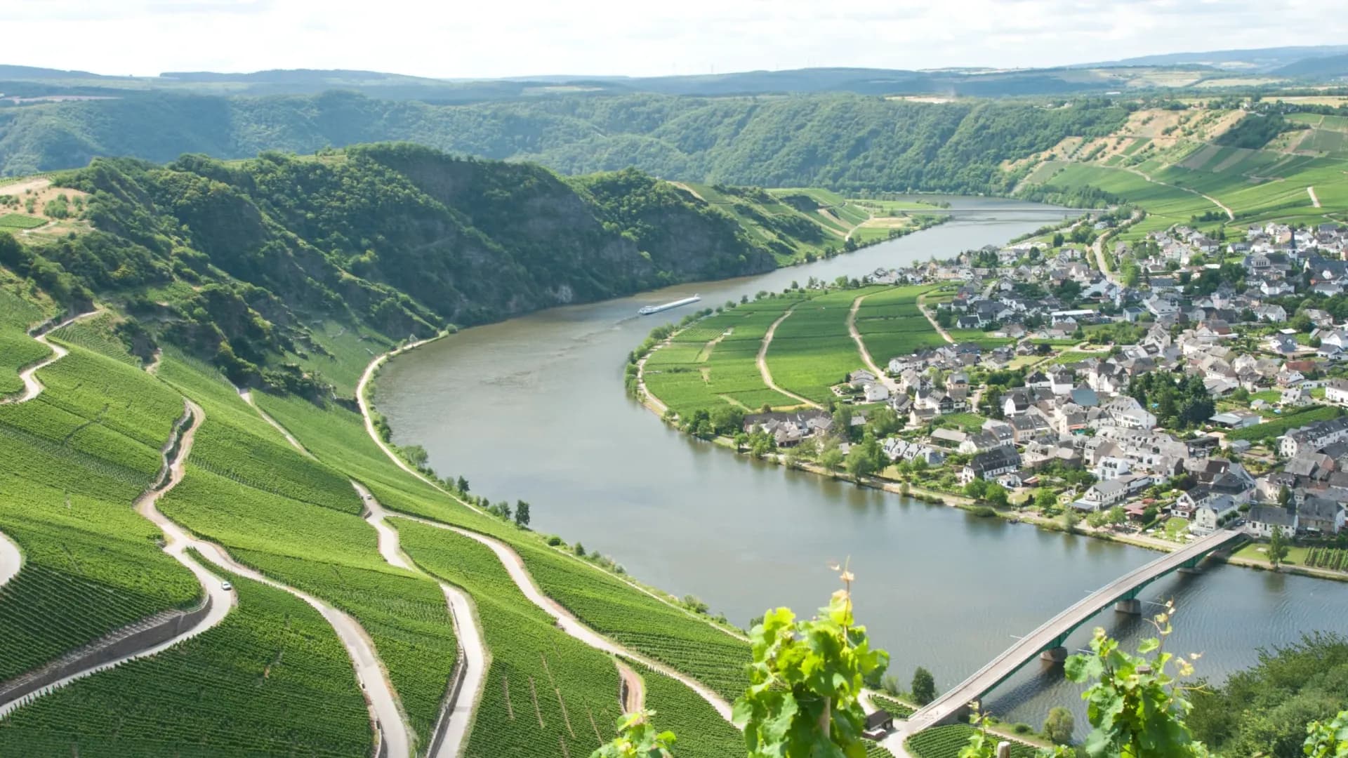
From the Roman bridge in Trier the Mosel does most of the talking — vineyards, ferry rocks, and quiet climbs inland through Schweich, Fell and Föhren before the river gathers you again.

108 km

Distance

1,054 m

Elevation

6h10

Duration

2 ravitos

Ravitos

Leaving Trier along the Mosel

Trier starts a road ride the way only a riverside Roman city can: the Römerbrücke, the Zurlauben waterfront, then the Mosel cycle spine pulling you northeast. This loop follows the Saar-Mosel-Main corridor in spirit more than in pilgrimage — roughly one hundred eight kilometres, seven hundred fifty metres of climbing, and a day that stays mostly on asphalt and quiet road rather than gravel theatre.

Schweich arrives early, then the line lifts inland toward Fell — the Burgtor and the short climbs that make the valley feel steeper than the summit altitude suggests. Föhren sits in that middle register where vineyard roads give way to plateau edges and the Mosel drops out of sight just long enough to make its return feel earned.

The hardness here is not Alpine. It is repeated short climbs, river wind, and a surface mix that keeps the bike honest without asking for knobby tyres.

Vineyard towns and Roman pauses

Downstream names stack the way Mosel days always do: Trittenheim, the ferry rock viewpoint, Neumagen-Dhron with its Roman sarcophagi, Piesport and the Goldtröpfchen slopes. These are not mandatory café stops so much as a geography of wine villages that reward anyone willing to unclip. The track is majority road and asphalt — a little dirt and path if you follow the Outdooractive line pedantically, but the character remains road cycling.

SegmentNotes
Trier → SchweichRiver departure; Roman bridge and Zurlauben
Schweich → Fell / FöhrenInland lifts; Burgtor Fell; rolling plateau edges
Toward Trittenheim / NeumagenClassic Mosel vineyard corridor
Piesport → returnWinepress landmarks; roll back toward Trier

Closing the loop

The highest point sits near four hundred fifty metres — modest by mountain standards, enough to open views across slate and vines. When the road settles again toward Ehrang and the city, the day reads as a Mosel classic rather than a headline climb fest: long enough to empty bottles, gentle enough to finish talking. Bring a layer for the river wind and treat Sundays as a resupply problem — this valley closes early when it feels like it.

108 km

Distance

1,054 m

Elevation

Average gradient

449 m

Summit altitude

Before you go

  • SurfaceMostly asphalt and road (~97%). Fine on standard road tyres; ignore the minor dirt/path segments if you prefer pure tarmac.
  • EffortHard for the region by duration (~6h) and rolling climbs, not by Alpine gradient.
  • StartTrier (near Römerbrücke / Westbahnhof area). Rail access is straightforward.
  • ResupplySchweich, Trittenheim, Neumagen, Piesport — but many cafés close midday or Sunday.

This is the kind of place we write about every week.

Get the Ravito guide in your inbox.

No noise. Unsubscribe anytime.

Newsletter details