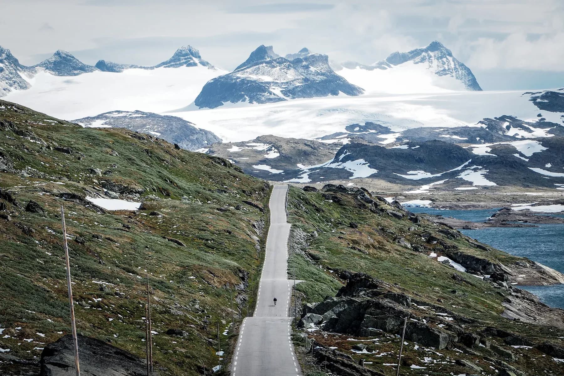
Sognefjellet & Tindevegen
At the head of Lustrafjorden the air still smells of salt and meltwater, and the road ahead rises toward a pass that Northern Europe treats as its roof. Two hors catégorie climbs — Sognefjellet and Tindevegen — ask for the same day, and neither offers much kindness between them.
129 km
Distance
4,134 m
Elevation
—
Duration
1 ravito
Ravitos
Skjolden and the first long climb
Skjolden sits where Lustrafjorden ends and the mountains begin to insist. The Sognefjellsvegen (RV55) leaves the water almost at once, winding past Fortun and into a climb that will not feel finished until Sognefjellshytta. Roughly twenty-four kilometres at around six percent take the road from fjord level to the high plateau; the hairpins tighten, the trees thin, and the sense of scale widens until the asphalt itself seems temporary against the rock.
Above the treeline the landscape turns spare — granite, lingering snow, and wind that arrives without ceremony. Fantesteinen marks the high point near 1,434 m, Northern Europe’s highest mountain pass road, with the Jotunheimen massif opening eastward and Galdhøpiggen sometimes visible on a clear day. Midsummer can still feel like another season up here: short sleeves in the valley, jackets and cold air at the lodge.
The day is not a loop in the gentle sense. It is two mountain roads stacked end to end, and the second does not wait for recovery.
Turtagrø, Hurrungane, and the Tindevegen plunge
From the summit the road drops toward Turtagrø, where the Hurrungane peaks — twenty-three summits above two thousand metres — fill the western sky. Here the ride turns onto Tindevegen, a narrow private mountain road that is free for cyclists. The descent toward Øvre Årdal is abrupt and technical: the valley floor appears far below while the road falls in steep, exposed ramps and hairpins with almost no traffic to announce what comes next.
Øvre Årdal returns the ride to sea level — a necessary pause before the hardest hours. The climb back toward Turtagrø runs about eighteen kilometres at roughly seven percent, with a lower sequence of tight hairpins that give way to long, straight ramps. On a warm afternoon the bottles empty early; meltwater streams beside the road become part of the calculus rather than scenery.
| Segment | Notes |
|---|---|
| Skjolden → Sognefjellshytta | RV55 from fjord level to 1,434 m; long HC climb, exposure above 1,200 m |
| Summit → Turtagrø | Alpine descent toward the Hurrungane junction |
| Tindevegen → Øvre Årdal | Private road, free for bikes; steep, quiet drop to sea level |
| Øvre Årdal → Turtagrø | Day’s hardest climb: hairpins then sustained ramps |
| Return to Skjolden | Reverse the Sognefjellet approach; cold air still possible late |
Closing the figure from the high country
Back over Turtagrø and down the Sognefjellsvegen, the fjord reappears with a softness that feels almost unreal after the plateau. The numbers — one hundred twenty-nine kilometres, more than four thousand metres of climbing — matter less than the shape of the day: altitude earned twice, with little flat ground to reset the legs. When the road finally settles beside Lustrafjorden again, the mountains behind Skjolden look less like a backdrop and more like a ledger of what has already been paid.
129 km
Distance
4,134 m
Elevation
—
Average gradient
1,434 m
Summit altitude
Full Sognefjellet & Tindevegen
129 km · 4134 m
Figure-eight from Skjolden: Sognefjellet to 1,434 m, Tindevegen down to Øvre Årdal and back.
Sognefjellet out-and-back only
Turn at Sognefjellshytta if weather or legs counsel against Tindevegen on the same day.
Before you go
- SeasonBest from late spring through early autumn when Sognefjellsvegen and Tindevegen are open; check Statens vegvesen after heavy winters.
- Tindevegen accessPrivate toll road for cars; cyclists ride free. Expect a narrow surface and almost no shelter.
- ResupplySognefjellshytta is the main high-altitude stop (typically May–October). Use Øvre Årdal between the two climbs; carry more than seems polite.
- Weather & layersConditions above 1,200 m can shift fast even in August. Pack a wind jacket and gloves for both descents.
- FitnessTwo HC climbs with little recovery. Suited to experienced riders who can hold a steady effort for many hours.