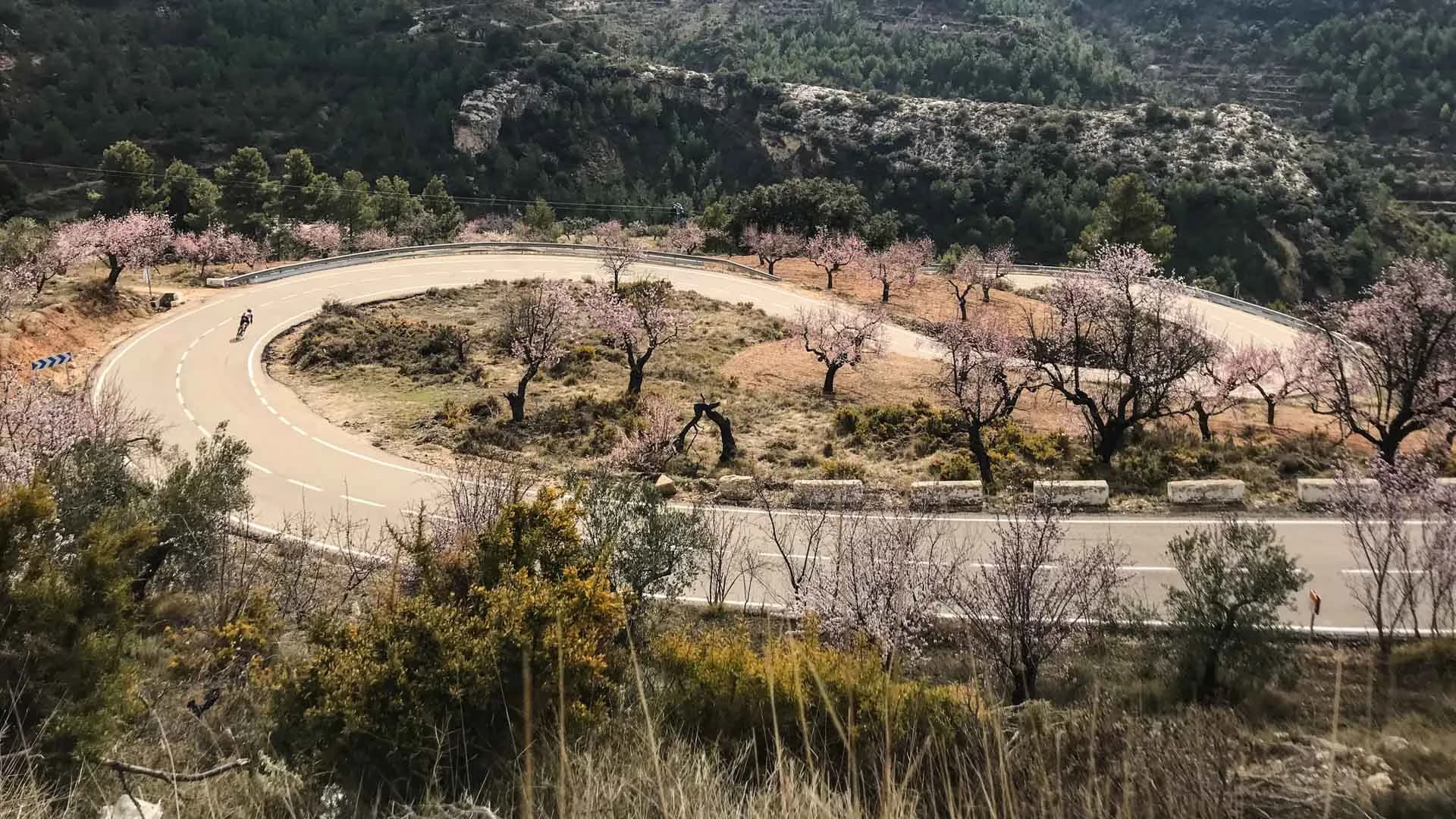
Calpe — Finestrat, Guadalest & Confrides — Five Climbs on the Costa Blanca
154 kilometres and 3,137 metres across five categorised climbs in the Costa Blanca interior. Finestrat, Port de Tudons, Torremanzanas, Benifallim, Confrides. No single climb breaks you — the accumulation does.
154 km
Distance
3,137 m
Elevation
8h20
Duration
3 ravitos
Ravitos
The Costa Blanca has a winter reputation built on sunshine and flat coastal roads. The reality behind the coastline is different: a compact mountain range that rises abruptly from the sea, a network of roads that connect inland villages nobody visits in summer, and a density of climbing that compares favourably with anything in continental Europe. Professional riders train here in December for a reason.
This route covers most of it in a single day.
The departure from Calpe is familiar enough — south through Altea along the coast, the Peñón de Ifach behind you, the Sierra Helada ahead. The first thirty kilometres are a transition: the road peeling away from the coastal strip, the mountains rising to the west, the Puig Campana massif appearing on the left — a jagged 1,406-metre summit that will be the route's dominant landmark for the first half of the day. Finestrat is a white village at the foot of the Puig Campana, and Bar El Cantonet in the square is the last café before the climbing begins. Stop here. Espresso, bocadillo, bottles filled. The Alt de Finestrat starts at the edge of town.
Alt de Finestrat is 3.9 kilometres at 5.1% — a Category 3 opener, compact, the gradient honest but manageable. The view back toward the coast improves with every turn of the pedal: the beach arc of Benidorm to the south, the Mediterranean flat and very blue, the Peñón already small behind you. This is the transition climb — not the hardest, but the one that closes the door on the coast and opens the door on everything else.
Then inland, and the route changes register.
Port de Tudons is the longest climb of the day: just under ten kilometres at 4.4% average from the lower segment, rising through a landscape that becomes progressively emptier and more severe. The road narrows above Tudons village. The gradient is consistent rather than aggressive — the kind of climb that doesn't announce its difficulty and accumulates it quietly. Tadej Pogačar set the Strava KOM on Port de Tudons in December 2025: 18 minutes and 1 second at 30.2 km/h. The benchmark is available if you want it, and entirely unreachable if you don't. Somewhere between those two facts is where most people ride. The route diverges from the full Tudons summit about five to six kilometres before the top, cutting across a narrow mountain pass through a gap in the rock before dropping toward the valley. Almost no traffic here. The road is good and the silence is complete. This is the inland Costa Blanca that the coastline conceals.
Torremanzanas comes at kilometre 90, which is where the route reveals what it is really asking of you. The Alto de Torremanzanas is 8.3 kilometres at 5.1% average — a Category 2 climb, mid-distance, with a profile that the average doesn't quite capture. The road alternates between near-flat passages and short ramps up to 15%, a rhythm variation that makes settling into a pace almost impossible. You arrive in the village of Torremanzanas — La Acequia in the Valencian — at 700 metres above sea level, the kind of mountain village where the café tables are outside and the coffee arrives quickly. Restaurant La Font is the mid-route stop. Eat something substantial. The next two climbs are shorter but they are earned on what comes before.
Port de Benifallim follows immediately: 3.8 kilometres at 5.5%. Short in absolute terms, but positioned at kilometre 100 with Finestrat and Tudons and Torremanzanas already in the legs. This is the climb where effort management from the first half of the day becomes arithmetic. There is no trick to it. Find a gear, hold the rhythm, reach the top.
The rolling terrain between Benifallim and the final climb is a brief reprieve — a few kilometres at manageable gradient through the Guadalest valley, the reservoir visible below, the road empty. Then the CV-710 to Confrides.
Puerto de Confrides is 9 kilometres at 4.5% average — the second-longest climb of the day, at kilometre 120, on legs that have climbed 2,700 metres already. In December 2025, Pogačar rode it at 30.2 km/h. The average conceals late ramps that kick above 8% in the final kilometres, and the altitude — the village of Confrides sits at 820 metres — means the air is thinner and cooler than at the start of the day. The landscape here has the quality of somewhere that doesn't receive many visitors: high, quiet, the coast invisible, the serra still going in every direction.
La Venta de Pep de Toni is at the top of Confrides. A rural bar, locals rather than cyclists, the kind of stop that exists because the village needs it rather than because a route does. The tosta is good. The coffee is fast. After this, 40 kilometres of descent and rolling coastal roads return to Calpe — the Guadalest valley opening progressively, the sea reappearing below, the afternoon light on the limestone doing what afternoon light on limestone does in this part of Spain.
The route is 154 kilometres. No single climb is exceptional — the Puig Major in Mallorca is harder, the Ventoux is longer, the Angliru is steeper. What makes this day unusual is the accumulation: five categorised climbs in a region where most visitors ride the coast and turn around. Patience and nutrition management determine how the last forty kilometres feel. Everything else is in the planning.
Route
153 km · +3,152 m · Road · 100% asphalt
| Climb | Profile | Position |
|---|---|---|
| Alt de Finestrat | Cat 3 · 3.9 km · 5.1% avg | km ~35 |
| Port de Tudons (lower section) | Cat 1 · 9.9 km · 4.4% avg | km ~50 |
| Alto de Torremanzanas | Cat 2 · 8.3 km · 5.1% avg | km ~90 |
| Port de Benifallim | Cat 3 · 3.8 km · 5.5% avg | km ~100 |
| CV-710 to Confrides | Cat 2 · 9.1 km · 4.5% avg | km ~120 |
| Stop | Position | Notes |
|---|---|---|
| Restaurant La Font, Torremanzanas | km ~70 | Mid-route — coffee, food, proper rest between Torremanzanas and Benifallim. Closed Tuesdays. |
| La Venta de Pep de Toni, Confrides | km ~110 | Final stop before the descent home — 40 km of rolling descent to Calpe after this. Closed Wednesdays. |
154 km
Distance
3,137 m
Elevation
6%
Average gradient
1,014 m
Summit altitude
Before you go
- Port de Tudons has two sectionshe route diverges from the full Tudons summit before the top, crossing a narrow mountain pass through the rock. Do not mistake the first plateau for the summit — the road continues beyond Tudons village. Follow the GPS.
- Torremanzanas is the hidden cruxOn paper it is the mid-route climb with a moderate average. At kilometre 90, with Finestrat and Tudons already done, the 15% ramps hit differently. This is where riders who have gone too hard in the first half begin to pay.
- The CV-70 between Altea and Finestrat carries fast traffic in the morningGet through the coastal section early — once you turn inland after Finestrat, the roads are quiet for the rest of the day.
- Start by 7:30 in summerThe descent from Confrides to Callosa is exposed to afternoon heat. The goal is to be off the final climb before midday. In the winter training season (October–March), the timing is more forgiving and the roads are occupied by the professional teams who base here — Visma, UAE, Bahrain, Bora all train in this area between November and February.