RAVITO.
8 saved
RoadClimbLoopFrance

Croix de Fer & Glandon

Two Tour de France cols linked from Bourg-d'Oisans in one loop: up the Combe d'Olle to the iron cross at 2,067 m, a short spur to the Glandon, then thirty-seven kilometres back past turquoise reservoirs — 79.1 km and 1,908 m of climbing that never quite finish when the descent begins.

79.1 km

Distance

1,908 m

Elevation

Duration

1 ravito

Ravitos

Romanche warm-up, then the Combe

Bourg-d'Oisans rolls nearly flat for ten kilometres along the Romanche, cool and quiet in the early hours. On the opposite wall the twenty-one bends of Alpe d'Huez stack like a diagram — a useful reminder of the day not chosen. Climbing starts at Allemont, last shop and bakery before the high country, past the Barrage du Verney, then eleven kilometres up the Combe d'Olle. Mountain walls close both flanks; Le Rivier d'Allemont is the only hamlet stop between here and the top.

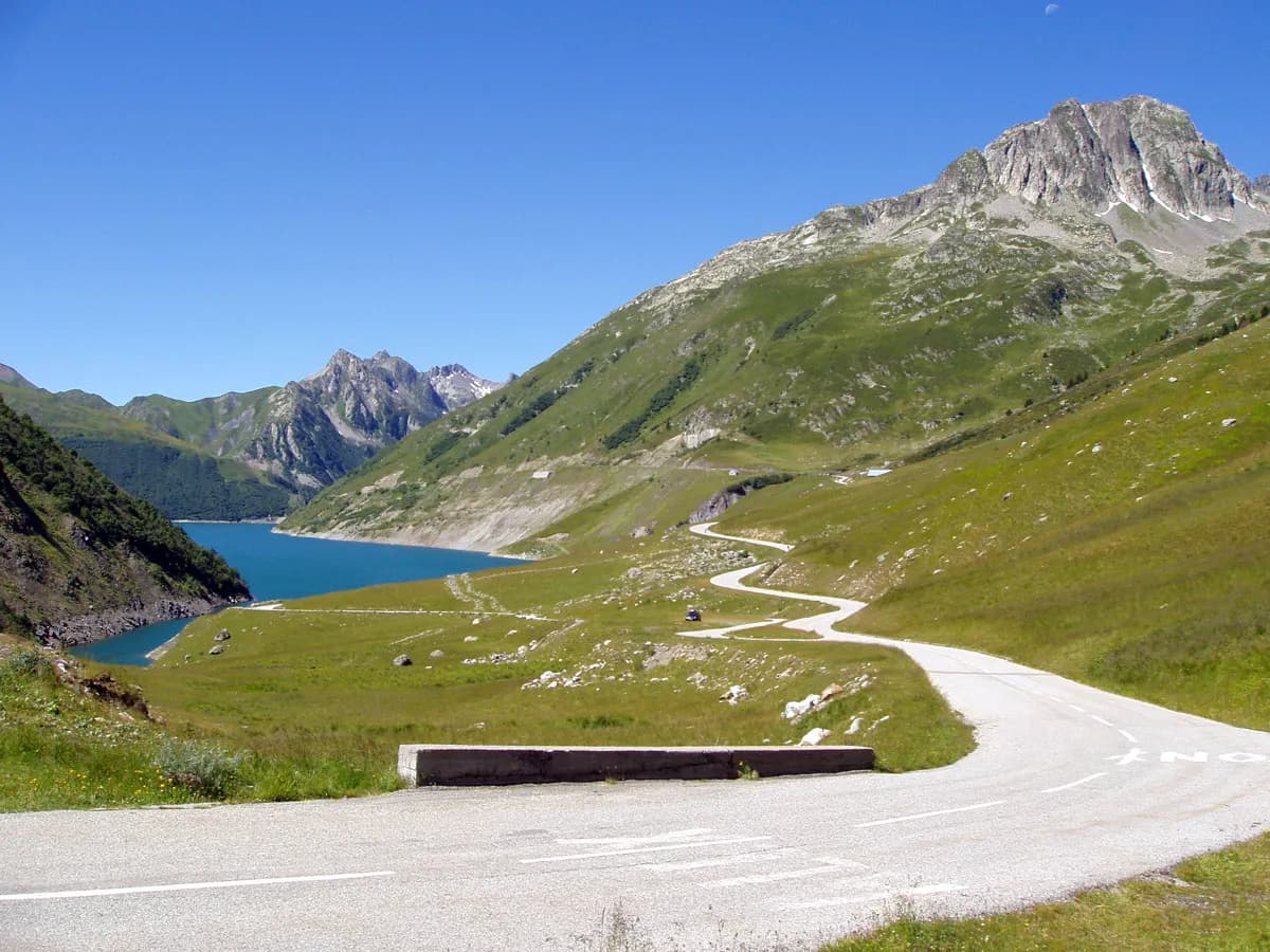
Past Rivier the road drops a hundred metres — what has just been gained, gone — then throws the steepest kilometre of the route at over 11%. Above the trees the valley opens. Lac de Grand Maison sits turquoise far below on the right; southward the Aiguilles d'Arves stand on the horizon like broken teeth. The final ramps to Col de la Croix de Fer run 7–9% through emerald pasture and grazing cows. At 2,067 m the iron cross and stone signpost point toward Saint-Jean-de-Maurienne and Saint-Colomban-des-Villards; the buvette sells coffee, Coke, and a slice of tarte aux myrtilles.

The link across to the Glandon is only a few kilometres — and often the stretch remembered longest.

Glandon spur and the false descent

Three kilometres back the way you came, then a right onto the D927, delivers Col du Glandon at 1,924 m: sign, car park, small hut on a narrow spur with gravel patches that punish haste. From here the “descent” to Bourg is thirty-seven kilometres that are not one go — four climbs remain, 231 metres in total, the longest between roughly km 55 and 58, landing when the legs have stopped expecting them. A windproof is worth having even on a warm day; valley floor tailwind into Bourg is the mercy at the end.

SegmentNotes
Bourg → AllemontFlat Romanche warm-up; last shops
Combe d'Olle11 km; Rivier the only mid-stop
Drop then wall−110 m, then 11%+ kilometre
To Croix de FerOpen high mountain; summit 2,067 m
Spur to GlandonNarrow D927; 1,924 m
Valley return37 km with four punchy climbs

Why ride both

Most riders tick one pass and leave. Stacking Glandon and Croix de Fer on the same Oisans loop is the bucket-list version: two HC names linked by a high alpine shoulder, one turquoise reservoir corridor, and a return that still asks for watts after the photographs. Seventy-nine kilometres and nearly nineteen hundred metres — it does not need embellishing. Check the D926 is open, and go.

79.1 km

Distance

1,908 m

Elevation

Average gradient

2,067 m

Summit altitude

Before you go

  • Road statusCheck the D926 is open. Some years the pass stays shut well into May; there is no alternate from the Oisans.
  • ResupplyLe Rivier d'Allemont (~km 21) is the only stop before the Chalet du col. Eighteen kilometres of emptiness follow.
  • GearingThe 4–5% averages hide 11% ramps after the mid-climb drop. Bring a gear that works at double digits.
  • DescentFour climbs sit in the last 37 km. Keep a windproof; the Glandon spur has gravel patches.

This is the kind of place we write about every week.

Get the Ravito guide in your inbox.

No noise. Unsubscribe anytime.

Newsletter details